
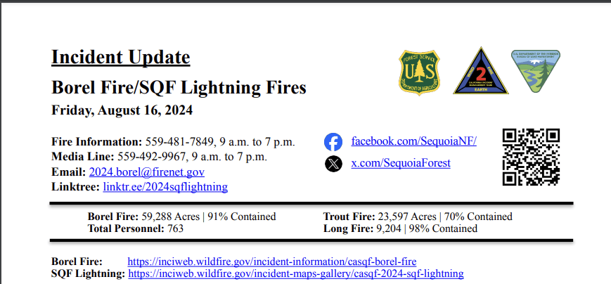
FOR IMMEDIATE RELEASE Friday august 16, 2024
Borel Fire: We are thankful for the many personnel that have come from out of the area to help with the fires here
in Southern California, including two crews from Saipan (the largest of the Northern Mariana Islands, a U.S.
commonwealth in the Western Pacific). Fire crews continue to work together to repair and restore natural features
throughout the fire area. The Burned Area Emergency Response (BAER) team is assessing potential post-fire
impacts to the burned watersheds. The BAER team will produce a report that describes potential threats associated
with the burned area’s post-fire conditions. There will be delays while traveling through the fire area due to work
being done by fire crews and utilities workers. *Residents only* are allowed to access their properties in the closed
Forest areas.
Trout Fire: Crews are working on constructing fire line on the western edge of the fire. Firefighters are patrolling
the area to mitigate isolated heat sources inside the fire perimeter. Fire suppression repair operations continue
across the fire area.
Long Fire: The fire is being monitored and does not pose a threat.
Sequoia National Forest & BLM Closures & Restrictions: The Borel Fire Piute Mountains Area Closure begins
at the northwest corner of Section 30, Township 27 South, Range 33 East, Mount Diablo Base and Meridian, then
continues approximately 47 miles around the Sequoia National Forest Boundary to the starting point.
All orders,maps, and accompanying appendices can be found on the Forest’s website: tinyurl.com/2en2d36k.
The Bureau of Land Management Bakersfield Office is lifting the emergency closure of the Creek Campground, a
portion of the Pacific Crest Trail, and Canebrake Road in Tulare County. The closures were in place for public and
firefighter safety in relation to the management of the SQF Lightning Complex Fire and are no longer necessary
due to the lack of fire progression.
The closures are lifted as of Tuesday, August 13. Long Valley Campground and
Long Valley Loop road remain closed. View the emergency closure order here: https://tinyurl.com/5n8rxcxh.
Road Closures: Sections of the Sherman Pass Rd (22S05) have opened, but it is not fully passable. West side M99
to Sherman Pass (22S05) to Cherry Hill Rd (22S12) has opened to Horse Meadow campground.
Big Meadow and
beyond is closed. The Sherman Pass Rd continuing East is closed. Coming up on the East side 9mile road (J-41) to
Sherman Pass is open to the Blackrock intersection.
Areas North to Blackrock trailhead and OHV trails are open,
Monache trail is open, and Troy and Fish Creek campgrounds are open. The road continuing West is closed at the
intersection.
[For the closure map and full closure order, visit: tinyurl.com/stj6k5zt.] Visit the Kern County Public
Works Department website for the additional information on county road closures (tinyurl.com/z6crvp6t).
Evacuations: There are no fire evacuations in place. Everyone in areas of active fires should “Know Your Zone.”
Go to Genasys Protect (tinyurl.com/jcdv55f9) to identify the zone you reside in.